
Ruas e Elevados / Streets and Highways
>> sábado, 14 de fevereiro de 2009
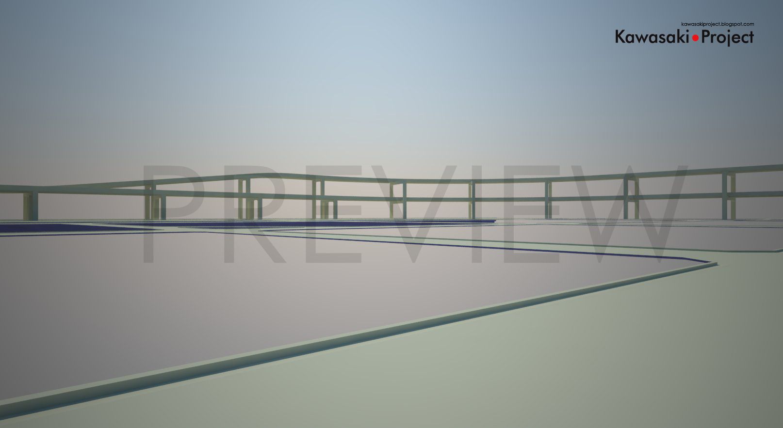
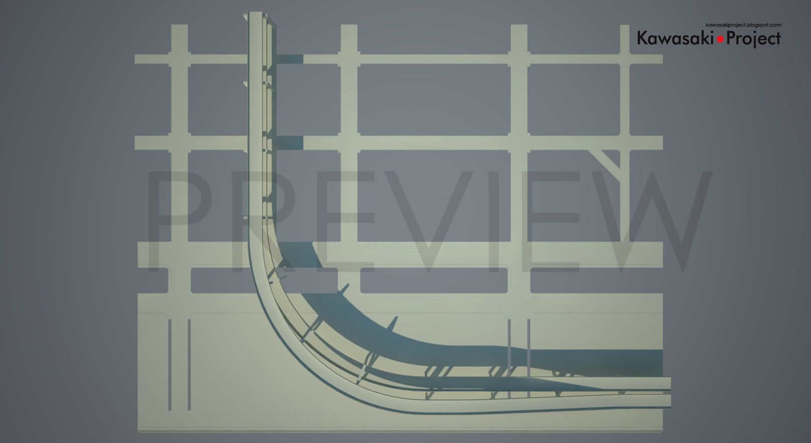
Ruas e Elevados, o ponto inicial do meu mapa. O layout ainda não é 100% definitivo, tudo depende ainda das construções a serem adicionadas, mas pelo menos a composição já dá uma idéia do que se esperar.
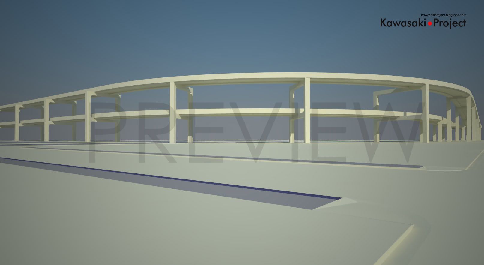
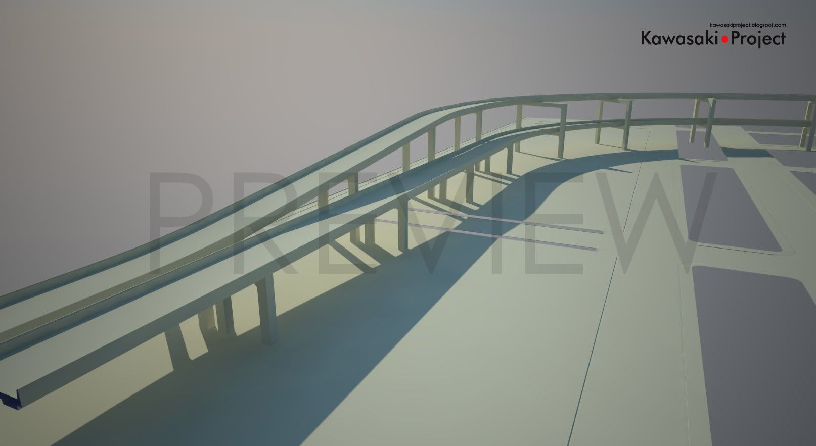
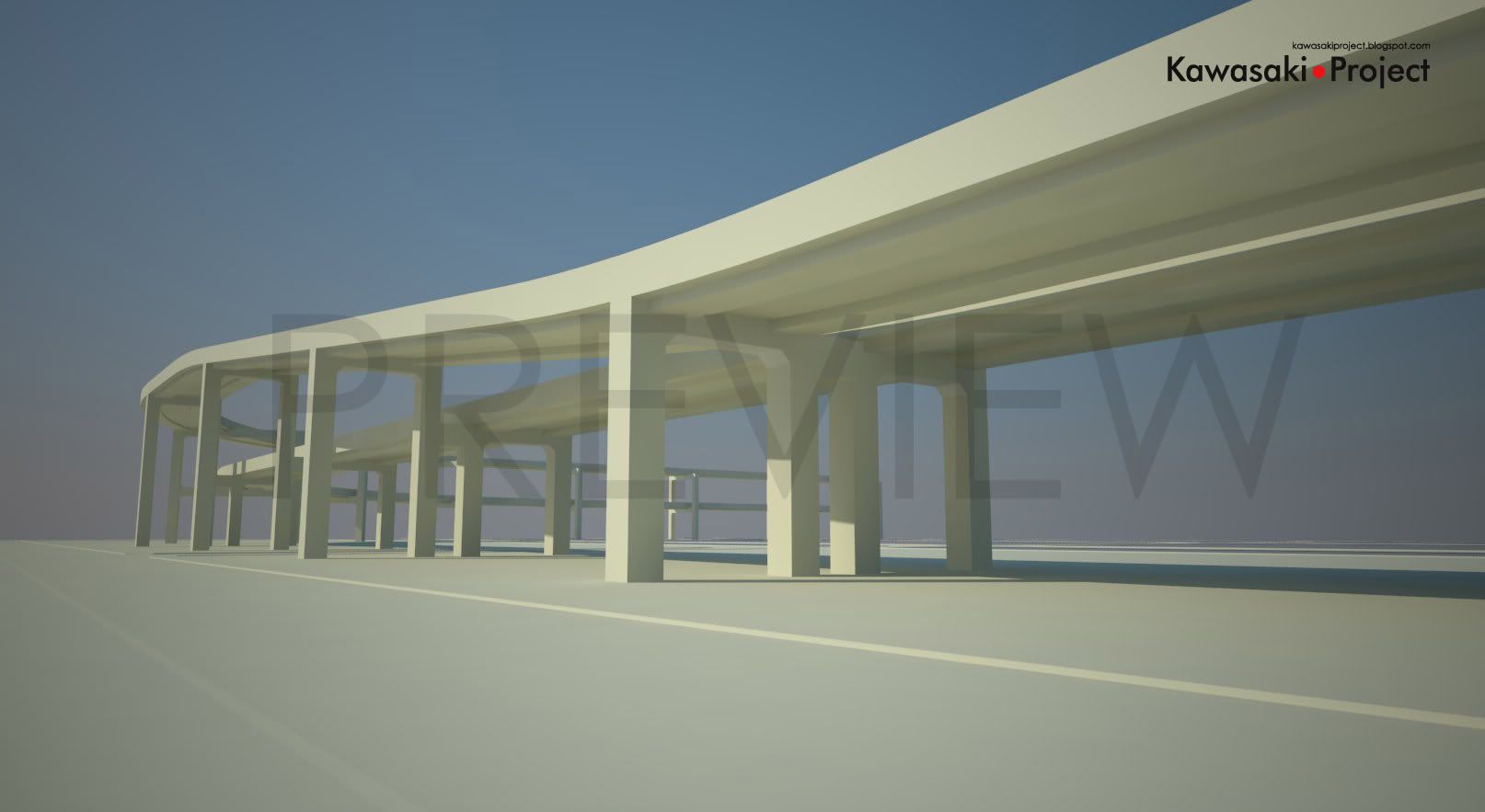
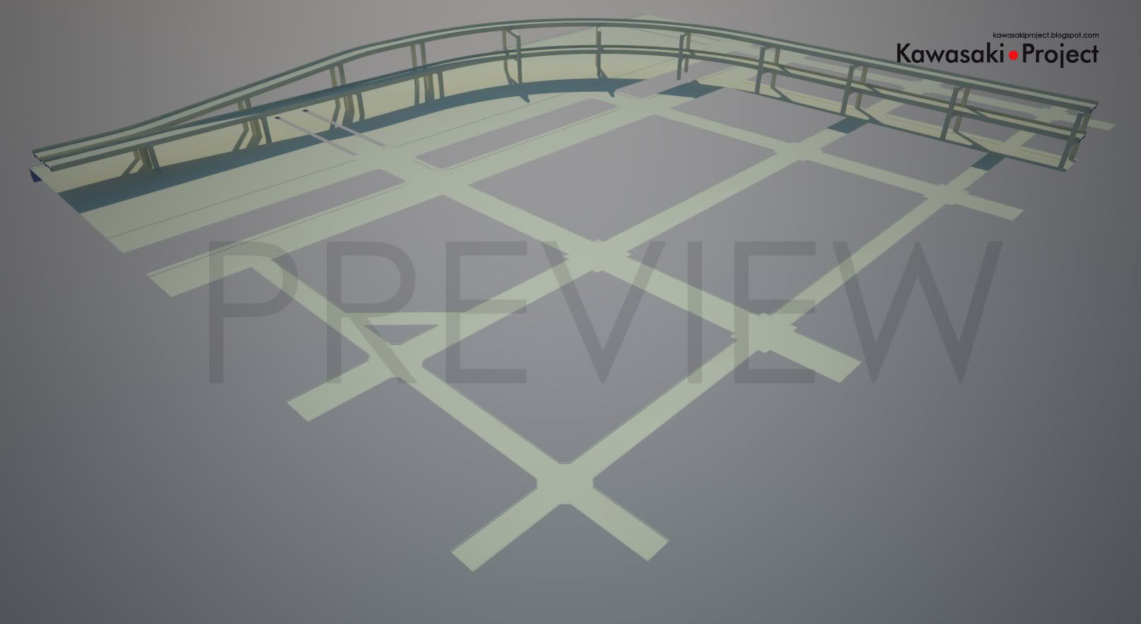
Os elevados foram modelados através de um simples processo de extrusão ao longo de uma linha, usando-se a ferramenta “Follow Me” do Sketchup. A maior dificuldade aqui foi traçar a linha a ser seguida, de forma que tanto a curva quanto a transição de uma pista sobre a outra para pistas paralelas fosse a mais suave possível.
Já as bases de sustentação dos elevados foram trabalhadas de forma a serem modulares, facilitando assim o reposicionamento e futura texturização das mesmas. De resto, ainda falta modelar as barreiras de som nas bordas laterais do elevado, semelhante às existentes na realidade.
As ruas foram mais simples de serem modeladas, uma vez que todo o mapa se situa em uma região plana, elas foram extrudadas de uma seção plana, de forma a manter a proporção de suas medidas. As esquinas foram geradas através de círculos geométricos simples. Por enquanto, esse será o layout do mapa quanto à composição das quadras. Dependendo da evolução do trabalho, mais ruas e seções do podem vir a serem adicionadas, podendo ter inclinações diferentes...
English:
Streets and Highways, the starting point of my map. The layout is still not 100% definitive, everything depends on the buildings that are yet to be added, but the composition of it already gives an idea of what to expect.
The Highways have been modeled by a simple process of extrusion along a line, using the “Follow Me” tool of Sketchup. The main difficulty here was to draw the guide line, so that not only the curve, but the transition of one track above another to a parallel track layout was the smoothest one.
The Highway Support’s were modeled to be modular, making it easy to reallocate them if necessary and texture them. For the rest, sound insulation barriers need to be modeled on the lateral edges of the highway, just like the ones in real life.
The streets were simpler to be modeled, since the entire map is sitting on a flat region. They were extruded from a measured flat section of a plane, being careful to keep their proportions right when compared to the real world. The corners were generated by simple geometric circles.
For now, this is the layout of the map as the composition of the neighborhood blocks goes. Depending on how the progress work goes, more sections of streets are likely to be added, even having different shapes and degrees of inclination.

0 comments:
Postar um comentário